Building
New Ground
Mississauga
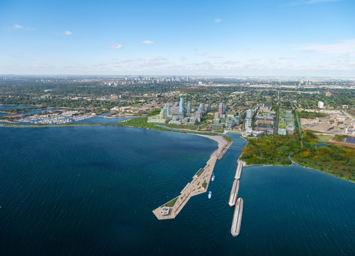
Lakeview Village
Active
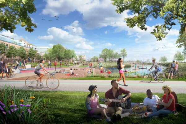
Lakeview Village promises to breathe new life into Mississauga’s waterfront as it transforms an abandoned coal-fired power plant into a vibrant, sustainable and more connected community.
Oakville
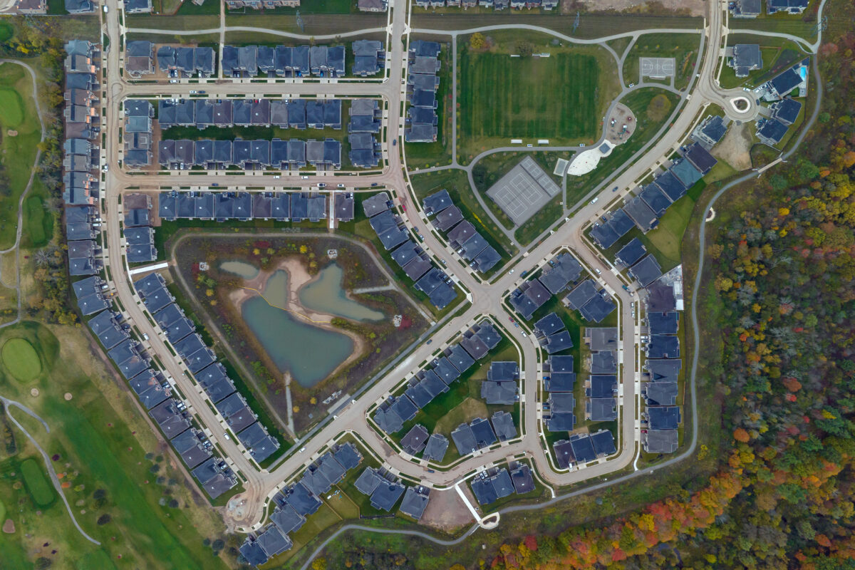
Bronte Green
Active
This mixed-use community offers a wide range of housing and promotes a livable and healthy lifestyle, all within close proximity to an exceptional trail network that connects to an enhanced Regional Natural Heritage System.
Oakville
EMGO I&II
Active
Surrounded by natural reserves, a protected ecosystem, neighbourhood parks and a vibrant urban core, EMGO North Oakville offers live/work opportunities coupled with a strong focus on walkability and transit.
Leading-edge land development.
25+ years of experience.
We believe in Building New Ground – developing sustainable, future-ready communities that integrate home, work and play; places where people connect to nature, transit, and the amenities of modern living.
We believe in partnerships built on loyalty, integrity, and transparency. Proudly, many of our partners have been with us since our very first project, and are still part of our Argo family.
Working primarily in the Greater Toronto Area (GTA) in Ontario, we are proud to develop neighbourhoods that people call home.
March 22, 2024
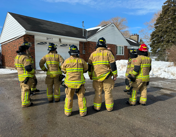
Fostering Community Engagement: Developers’ Role in Providing Essential Training Opportunities for Local Fire Departments
In collaboration with the Oakville Fire Department, ARGO Development is happy to provide real-life training opportunities on the sites of our future communities. When a property is acquired for land development, it often includes existing structures slated for future demolition. These structures offer firefighters a valuable opportunity to practice their skills in real-time with a real house.
March 7, 2024
Crafting Community: How Lakeview Village Is Redefining Neighbourhood Design
What does it mean to build a complete community? It means creating something that enhances the quality of life of each resident – from the physical to the mental. It means providing a diversity of housing that will accommodate people at all ages and stages of life, and providing a wide range of employment opportunities, amenities, and services all within a 15-to-20-minute walk from a person’s front door. Read more here.
February 28, 2024
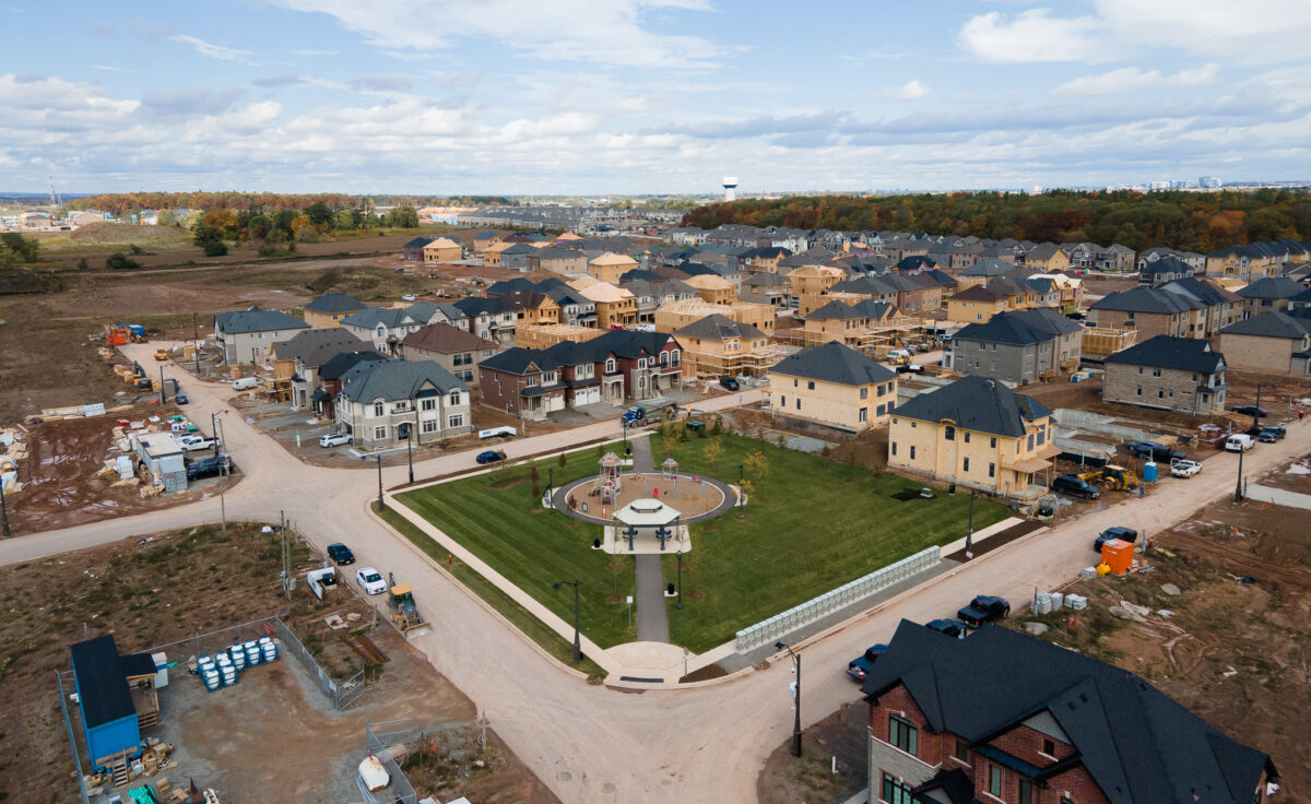
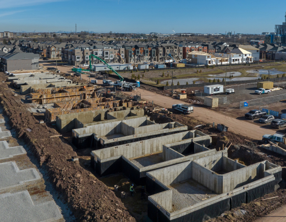
Construction Commences at Joshua Creek Montage – Oakville’s Premier Upcoming Community
Our Joshua Creek project is undergoing a remarkable transformation this year! From excavation, footings, foundations, and framing, our award-winning home builders begin the next phase of bringing this future Oakville community to life.
Follow along,
to see what’s new.
To follow along with updates on all of our projects, find us on instragram or click on any of the posts below.
Presenting our Mt. Pleasant Heights project in Northwest Brampton! Thanks to the diligent efforts of our hardworking crews, the site has advanced through crucial stages of development 🚜 from earthworks to utilities and everything in between. Visit our website for more information on this vibrant upcoming community 🏡
Tags: #BuildingNewGround #LandDevelopers #landdevelopment #GTA #The6ix #ArgoDevelopmentCorp #NewDevelopmentsTO #UrbanToronto #Construction #RealEstate #RealEstateTO #RealEstateDevelopment #NewConstruction #UrbanDevelopment #CommunityDevelopment #GrowBrampton #BuildingCommunities #BuildingRelationships

Progress check in at our @mylakeviewvillage project along the Mississauga waterfront
Tags: #LandDevelopers #landdevelopment #GTA #The6ix #ArgoDevelopmentCorp #NewDevelopmentsTO #UrbanToronto #Construction #RealEstate #RealEstateTO #lakeontario #mylakeviewvillage #sustainabledevelopment #reuserecycle #RegionofPeel #cityofmississauga #waterfrontdevelopment #sustainabledevelopment #BuildingCommunities #BuildingRelationships
Check in on our Joshua Creek project as it continues its remarkable transformation 🏡
Tags: #JoshuaCreekMontage #Halletthomes #Primont #Valeryhomes #Argodevelopments #townhomeliving #Luxurytownhomes #townhomelife #findyourhome #Architecture #LuxuryHomes #DreamHome #LivingLuxury #TorontoHomes #firsttimehomebuyer #GTAhomes #GTAlistings #torontointeriordesign
This galvanized steel pedestrian bridge, measuring 34m long and weighing over 27,000kg, was expertly fabricated and installed by Algonquin Bridge for our West Morrison Creek project in Oakville. It will offer future residents a safe and scenic passage over the naturalized channel, seamlessly connecting to the pond trail. 🌱🏗️
Tags: #BuildingNewGround #SiteServicing #LandDevelopers #landdevelopment #GTA #The6ix #oakvillerealestate #oakville #townofoakville #ArgoDevelopmentCorp #builtbyargo #NewDevelopmentsTO #UrbanToronto #Construction #newconstruction #RealEstate #RealEstateTO #BuildingCommunities #BuildingRelationships
The Saw Whet at Bronte Green
How it started ➡️ How it’s going
Tags: #BuildingNewGround #SiteServicing #LandDevelopers #landdevelopment #GTA #The6ix #oakvillerealestate #oakville #townofoakville #ArgoDevelopmentCorp #builtbyargo #NewDevelopmentsTO #UrbanToronto #Construction #newconstruction #RealEstate #RealEstateTO #BuildingCommunities #buildingrelationships
Utilizing an existing structure slated for demolition last year, ARGO Development was able to provide the Oakville Fire Department with a valuable training opportunity to practice their skills in real-time. Thank you to the firefighters and all first responders for everything you do to help keep our communities safe.
Tags: #BuildingNewGround #FirstResponders #CommunityEngagement #LandDevelopers #landdevelopment #GTA #The6ix #oakvillerealestate #oakville #townofoakville #ArgoDevelopmentCorp #builtbyargo #NewDevelopmentsTO #UrbanToronto #Construction #newconstruction #RealEstate #RealEstateTO #BuildingCommunities #buildingrelationships